Mount Pleasant, DC Neighborhood Guide
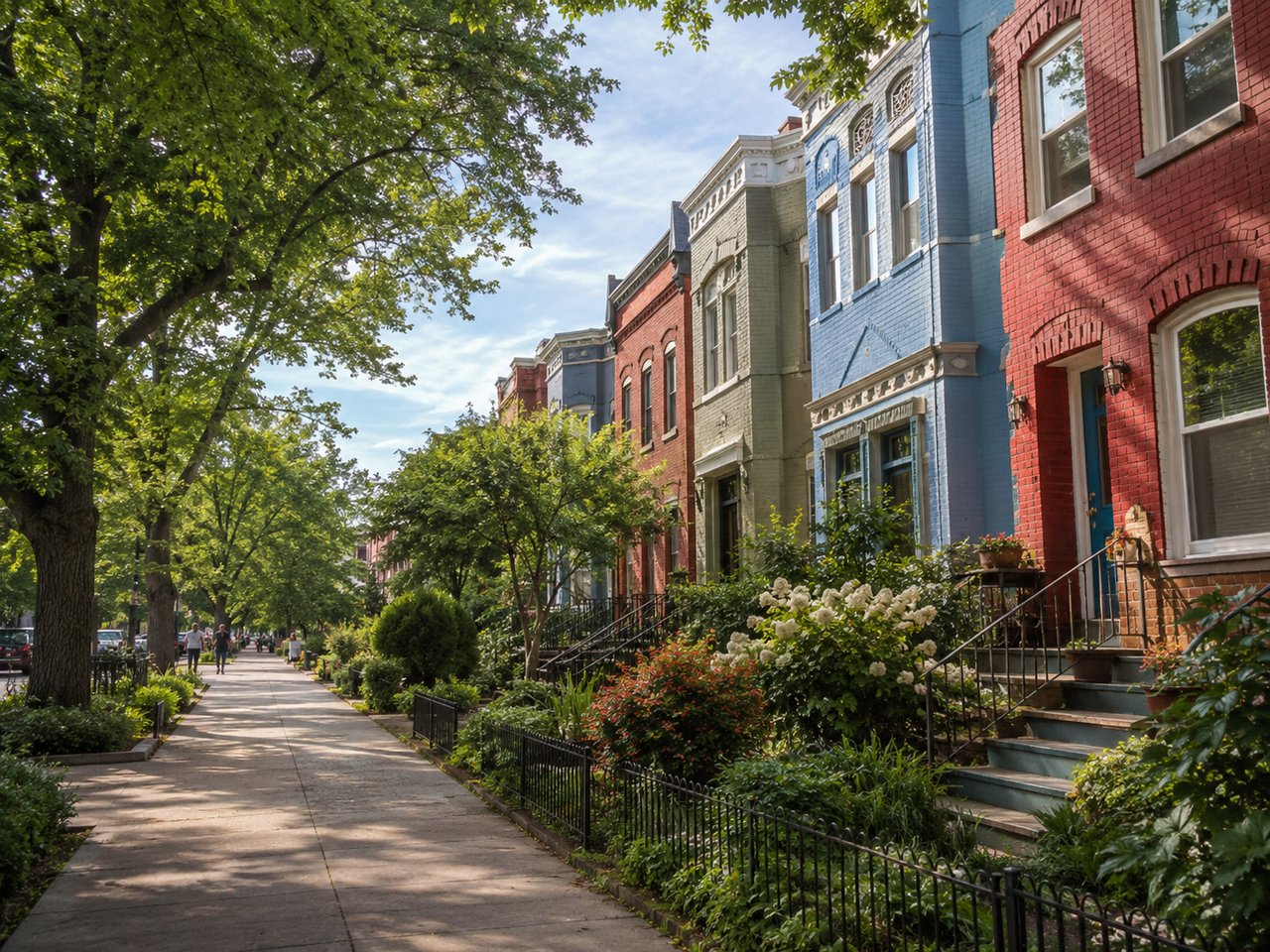
Mount Pleasant sits in Northwest DC between Rock Creek Park and 16th Street NW, north of Adams Morgan and west of Columbia Heights. The neighborhood centers on Mount Pleasant Street NW with local shops and services. Tree lined side streets feature early twentieth century rowhouses and smaller multifamily buildings. Rock Creek Park borders the neighborhood, providing trail access and connections to the broader park system.
Fast Facts
-
Location: Northwest DC between Rock Creek Park and 16th Street NW
-
Main Corridors: Mount Pleasant Street NW for retail and services, 16th Street NW for north south travel
-
Parks and Plazas: Rock Creek Park along the western edge, Lamont Park on Mount Pleasant Street NW, Klingle Valley Trail connection nearby
-
Housing Types: 1900s to 1930s rowhouses, small apartment and co-op buildings, limited mid rise residences near 16th Street NW
-
Transit: Columbia Heights Metrorail station on the Green and Yellow Lines within walking distance for many addresses, Metrobus routes on 16th Street NW and Mount Pleasant Street NW, Capital Bikeshare docks on key corners
-
Nearby: Smithsonian’s National Zoo in Rock Creek Park, Adams Morgan to the south, Columbia Heights to the east
Overview and History
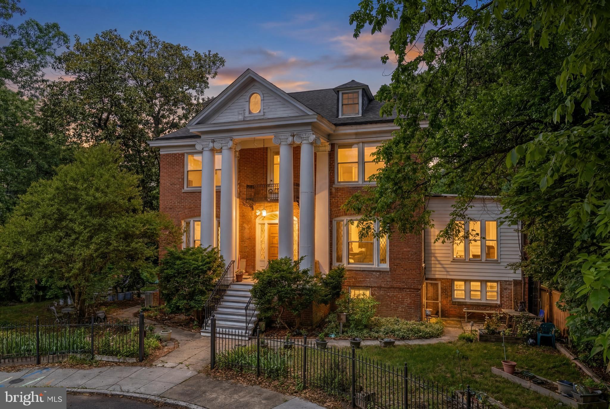
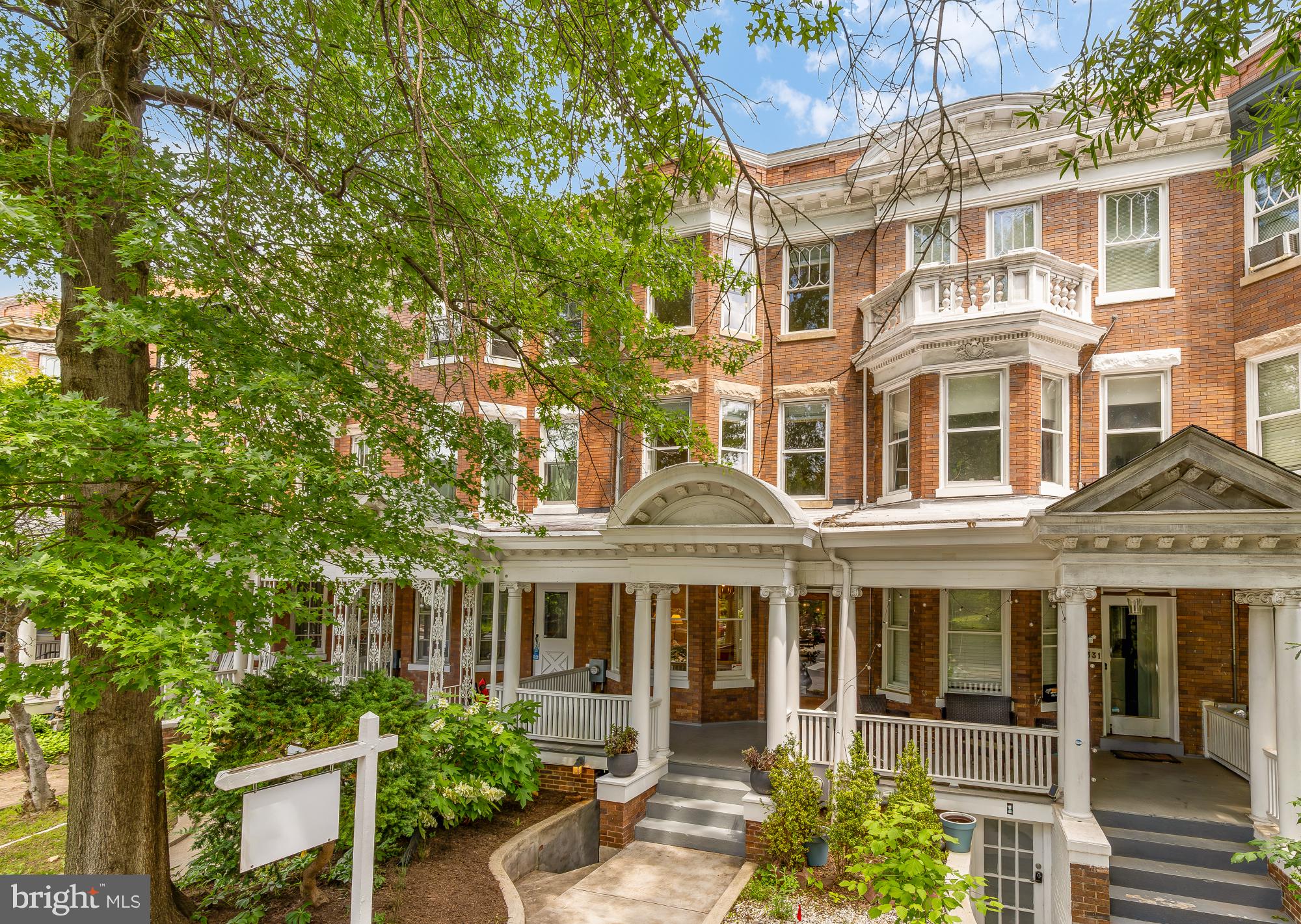
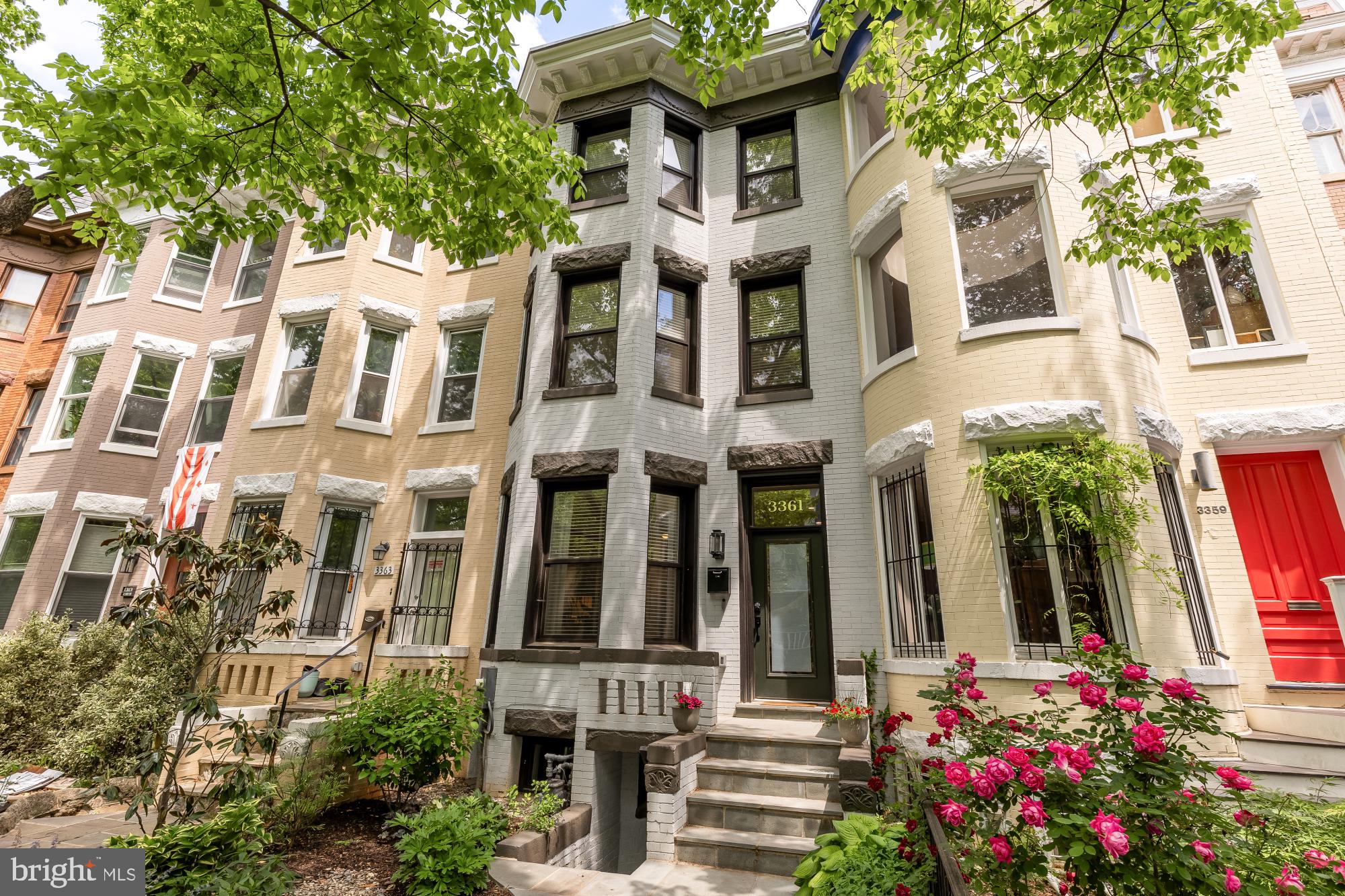
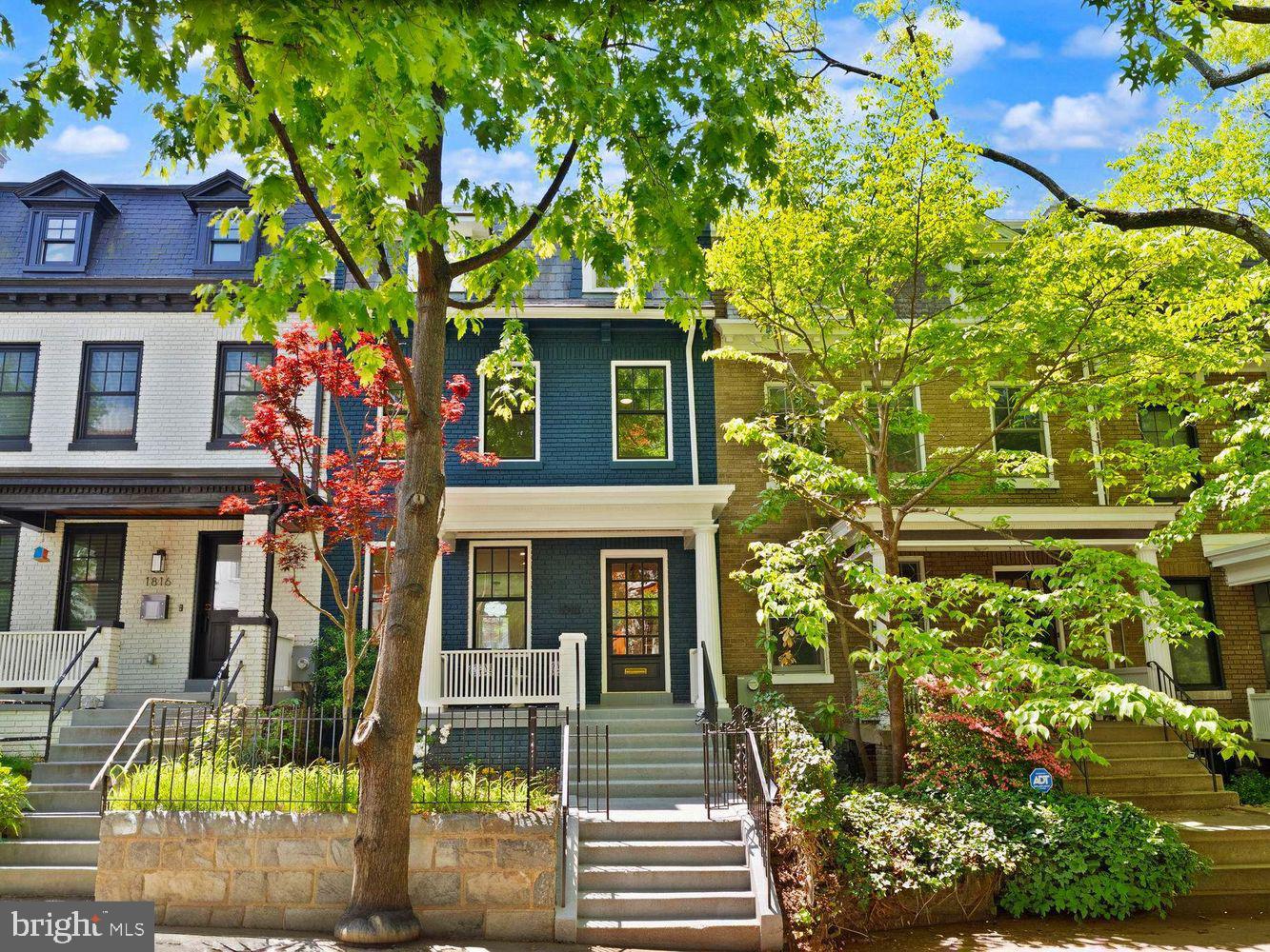
Mount Pleasant developed during the streetcar era with a walkable grid and a main street oriented to daily needs. Many rowhouses date from the early 1900s with masonry facades and bay fronts. Apartment and co-op buildings cluster near 16th Street NW and along the commercial spine. The neighborhood’s location next to Rock Creek Park adds access to trails and nature within the District.
Lifestyle and Amenities
Shops and Services
Mount Pleasant Street NW offers grocery, pharmacy, cafes, and service businesses. Seasonal markets and community events occur at Lamont Park and nearby plazas on a posted schedule.
Dining and Coffee
Cafes, restaurants, and bakeries line Mount Pleasant Street NW and adjacent blocks. Options change over time, and many venues post updated hours on storefronts and websites.
Parks and Recreation
Rock Creek Park provides paved and natural-surface trails for running and cycling. The Klingle Valley Trail connects to Porter Street NW and Woodley Park. Lamont Park serves as a neighborhood gathering space with seating and periodic programmed events.
Institutions and Nearby Attractions
The Smithsonian’s National Zoo is located in Rock Creek Park to the west with public entrances on Connecticut Avenue NW. Cultural venues in Adams Morgan and Columbia Heights are within a short distance.
Housing and Real Estate Snapshot
Mount Pleasant offers a range of home types shaped by early twentieth century development.
-
Rowhouses
Brick and stone facades with bay fronts, front porches or stoops, and rear terraces or yards. Some properties include lower level spaces that may be configured for storage or accessory use subject to District regulations. -
Apartments and Co-ops
Smaller elevator and walk-up buildings near 16th Street NW and along Mount Pleasant Street NW. Common features can include bike storage and shared outdoor space where offered. -
Condominiums
Select conversions and infill buildings add condo options near the main corridor.
If you are comparing a rowhouse on a side street to a low maintenance condo near shops and transit, Roger can help you evaluate features, fees, and upkeep and match options to budget and timing.
Ask Roger: What fits my budget in Mount Pleasant
Share price range and move timeline to receive a tailored list of active and coming soon homes. Email Roger
Transportation and Accessibility
-
Metrorail
Columbia Heights on the Green and Yellow Lines is the closest station for many addresses east of the main corridor. Red Line stations at Woodley Park and Cleveland Park are across Rock Creek Park and may be reached via connecting trails and streets. Walking times vary by address and route. -
Bus
Metrobus operates frequent service along 16th Street NW and Mount Pleasant Street NW with connections to downtown and cross town routes. -
Biking
Capital Bikeshare docks are located on Mount Pleasant Street NW and nearby intersections. Trails in Rock Creek Park connect to north south bike routes. -
Driving and Parking
16th Street NW provides a primary north south route. Residential permit parking applies on side streets where posted. Metered or time limited spaces are located near commercial blocks.
Community Landmarks
-
Lamont Park on Mount Pleasant Street NW
-
Mount Pleasant Street NW retail corridor
-
Rock Creek Park trail access points along the western edge
-
Klingle Valley Trail connection near Porter Street NW
-
Smithsonian’s National Zoo nearby in Rock Creek Park
FAQs
- Where is Mount Pleasant in DC
Mount Pleasant is in Northwest DC between Rock Creek Park and 16th Street NW. It sits north of Adams Morgan and west of Columbia Heights with a main street along Mount Pleasant Street NW. - What types of homes are common in Mount Pleasant
Expect early twentieth century rowhouses on residential blocks and small apartment or co-op buildings near 16th Street NW and Mount Pleasant Street NW. Limited condo options appear in conversions and infill buildings. - How do residents commute from Mount Pleasant
Many use the Columbia Heights station on the Green and Yellow Lines, Metrobus on 16th Street NW and Mount Pleasant Street NW, and bike routes in Rock Creek Park. Driving routes use 16th Street NW and nearby arterials. - What parks are nearby
Rock Creek Park borders the neighborhood and offers trails and natural areas. Lamont Park provides a central plaza on Mount Pleasant Street NW. The Klingle Valley Trail connects to Porter Street NW. - Where can I run daily errands
Grocery, pharmacy, cafes, and services are concentrated along Mount Pleasant Street NW with additional options in nearby Columbia Heights and Adams Morgan.

Roger Taylor
m: 202.679.1750
[email protected]